Image Details
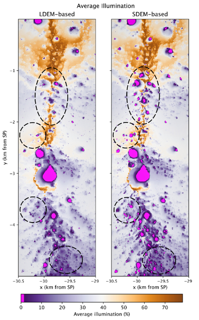
Caption: Figure 15.
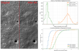
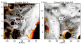
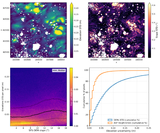
The uniform 5 m pix−1 effective resolution of the SDEM also results in more detailed terrain illumination results. For instance, the SfS-based average illumination map shows a finer distribution of low- and high-insolation areas (see dashed black circles along the Connecting Ridge Extension region), which are a critical asset for exploration planning and assessing resource availability.
Other Images in This Article
Show More
Copyright and Terms & Conditions
© 2026. The Author(s). Published by the American Astronomical Society.
Copyright ©
2026 Astronomy Image Explorer. All Rights Reserved.