Image Details
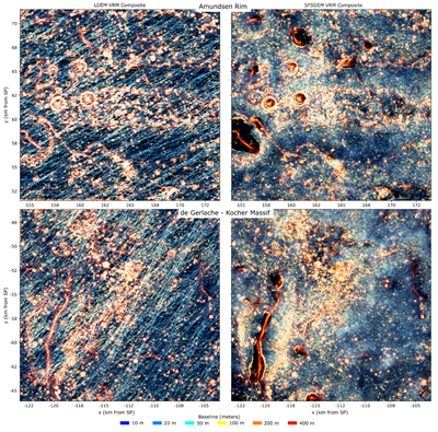
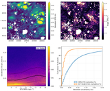
Caption: Figure 12.
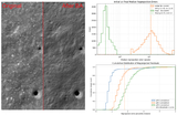
Composite color map of LDEM (left) and SDEM (right) terrain roughness at different baselines for the Amundsen Rim and de Gerlache–Kocher Massif regions. The SDEM-derived roughness reveals more fine-scale detail at baselines <100 m (blue to yellow tones; shadowed regions appear smooth/black in the SDEM). This highlights the value of leveraging SfS to obtain a more homogeneous representation of terrain features.
Other Images in This Article
Show More
Copyright and Terms & Conditions
© 2026. The Author(s). Published by the American Astronomical Society.
Copyright ©
2026 Astronomy Image Explorer. All Rights Reserved.