Image Details
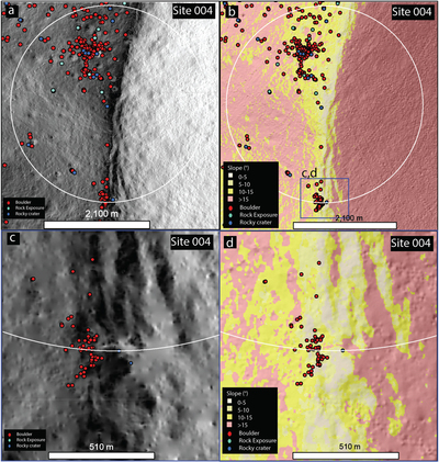
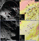
Caption: Figure 9.
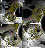
(a) 2 km exploration zone around site 004 shown on NAC mosaic (1 m pixel−1), all features shown. (b) 2 km exploration zone on LOLA (5 m pixel−1) derived slope map. The blue box shows the extent of c and d which are more accessible region with slopes less than 10°. (c) NAC mosaic at an accessible area within the ellipse. (d) Detail of the LOLA derived slope map. Scale bars in (a) and (b) are 2100 m and those in (c) and (d) are 510 m.
Other Images in This Article
Copyright and Terms & Conditions
© 2022. The Author(s). Published by the American Astronomical Society.
Copyright ©
2026 Astronomy Image Explorer. All Rights Reserved.