Image Details
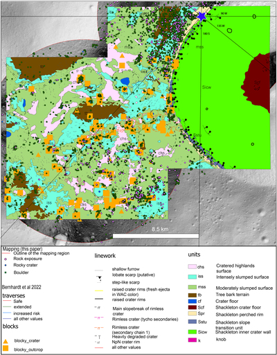
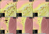
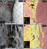
Caption: Figure 6.
Features mapped (isolated boulders, rock exposures, rocky craters) overlaid on the Bernhardt et al. (2022) geomorphological map. Distribution of features in relation to the geomorphic units can be seen, including around the “Connecting Ridge” the moderately slumped unit aligns with the mapped features. Blue star shows the location of the south pole (90°S) and longitude lines marked.
Other Images in This Article
Copyright and Terms & Conditions
© 2022. The Author(s). Published by the American Astronomical Society.
Copyright ©
2026 Astronomy Image Explorer. All Rights Reserved.