Image Details
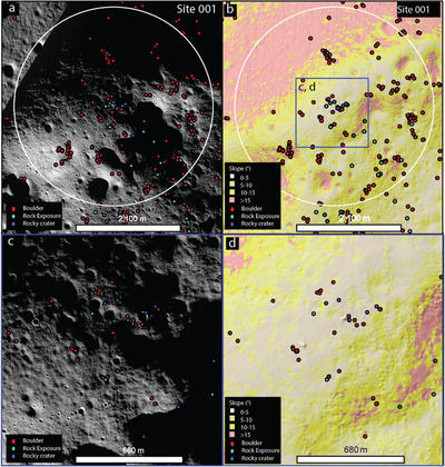
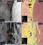
Caption: Figure 8.
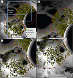
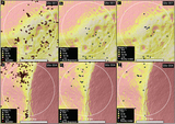
(a) 2 km exploration zone around site 001 shown on NAC mosaic (1 m pixel−1), all features shown. (b) 2 km exploration zone on LOLA (5 m pixel−1) derived slope map, blue box shows the extent of (c) and (d) which is a more accessible region with slopes of less than 10°. Scale bars in (a) and (b) are 2400 m and scale bars in (c) and (d) are 680 m. (c) NAC mosaic at more accessible area within the site 001 exploration zone. (d) Detail of the LOLA derived slope map.
Other Images in This Article
Copyright and Terms & Conditions
© 2022. The Author(s). Published by the American Astronomical Society.
Copyright ©
2026 Astronomy Image Explorer. All Rights Reserved.