Image Details
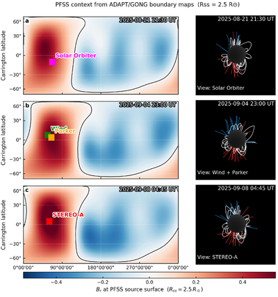
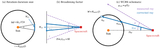
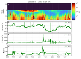
Caption: Figure 4.
PFSS context for the long-duration type IV event, computed from ADAPT/GONG boundary maps with source-surface radius Rss = 2.5 R⊙. Left panels: radial magnetic field Br at the PFSS source surface (red: Br > 0, blue: Br < 0); the source-surface PIL is shown in black. Squares mark the Carrington longitude/latitude of each observing spacecraft projected onto the source surface at representative times in the three visibility windows: (a) Solar Orbiter (2025 August 21 21:30 UT), (b) Wind and Parker Solar Probe (2025 September 4 23:00 UT), and (c) STEREO-A (2025 September 8 04:45 UT). Right panels: PFSS field lines traced from r = 1.2 R⊙ and rendered from the corresponding spacecraft viewpoint; closed field lines are white and open field lines are colored by polarity (red: Br > 0, blue: Br < 0). The PIL is located roughly ∼90° eastward of each projected spacecraft longitude at these epochs, suggesting that the relevant helmet streamer lies near the visible east limb from each viewpoint.
Other Images in This Article
Copyright and Terms & Conditions
© 2026. The Author(s). Published by the American Astronomical Society.