Image Details
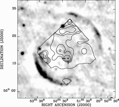
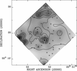
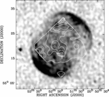
Caption: Fig. 7.
Left, 1.4 GHz NRAO VLA Sky Survey intensity map; right, 325 MHz Westerbork Northern Sky Survey intensity map. The scales are linear. The same 0.5–2 keV intensity contours as in Fig. 3, except for the highest level, are overlaid to show the positional correspondence of the PWN candidate (indicated by two tick marks) with the radio source.
Other Images in This Article
Copyright and Terms & Conditions
© 2007. The American Astronomical Society. All rights reserved. Printed in U.S.A.
Copyright ©
2025 Astronomy Image Explorer. All Rights Reserved.