

Image Details
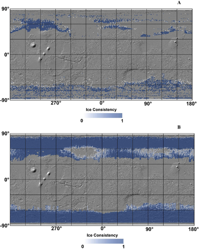
Caption: Figure 2.
Ice consistency (C) maps produced via the rule set in Section 3.3 for integration into the larger SWIM project. (a) CSWIM23, (b) CPQ19, (c) CBF08, (d) the combined product, CT, which effectively fills in the high-latitude “missing areas” in (a) with the results from (b) and (c)—note that CT decreases at the very highest latitudes because the BF08 map only extends to 80°N/S (c).
Other Images in This Article
Show More
Copyright and Terms & Conditions
© 2026. The Author(s). Published by the American Astronomical Society.

Copyright ©
2026 Astronomy Image Explorer. All Rights Reserved.
