

Image Details
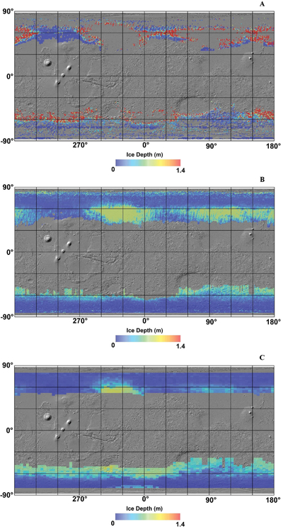
Caption: Figure 1.
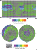
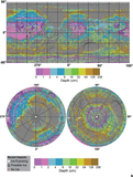
The three thermal ice detection maps compared in this analysis, from top to bottom: (a) The ice table depth map produced for the SWIM project using the techniques of N. E. Putzig & M. T. Mellon (2007) and N. E. Putzig et al. (2014). (b) Ice table depth map from S. Piqueux et al. (2019b). (c) Ice table depth map produced by J. L. Bandfield & W. C. Feldman (2008) with a modified latitudinal cutoff algorithm as described in the main text.
Other Images in This Article
Show More
Copyright and Terms & Conditions
© 2026. The Author(s). Published by the American Astronomical Society.

Copyright ©
2026 Astronomy Image Explorer. All Rights Reserved.
