Image Details
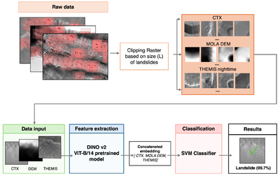
Caption: Figure 4.
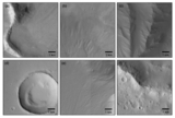
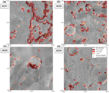
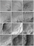
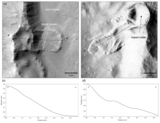
Workflow of the Mars-DiSVM framework. Landslide feature points and randomly generated nonlandslide feature points are first buffered into square polygons in ArcGIS Pro and clipped using customized window size (Figure 3) to generate image tiles. Corresponding CTX, MOLA DEM, and THEMIS tiles serve as the model input. Each image tile is processed through the pretrained DINOv2 model ViT-B/14 to obtain feature representations that are concatenated and passed to a support vector machine (SVM) for binary classification of landslide versus nonlandslide samples.
Other Images in This Article
Copyright and Terms & Conditions
© 2026. The Author(s). Published by the American Astronomical Society.
Copyright ©
2026 Astronomy Image Explorer. All Rights Reserved.