Image Details
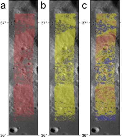
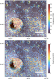
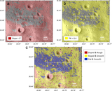
Caption: Figure 8.
Terrain identified as (a) sloped (>5°, red), (b) high TRI (>0.4 m, yellow), and (c) sloped/flat and smooth/rough, defined using slopes, SDS, and VRM parameter thresholds as described in the text for the Gruithuisen domes, where red = sloped and rough, yellow = sloped and smooth, and blue = flat and smooth.
Other Images in This Article
Copyright and Terms & Conditions
© 2026. The Author(s). Published by the American Astronomical Society.
Copyright ©
2026 Astronomy Image Explorer. All Rights Reserved.