Image Details
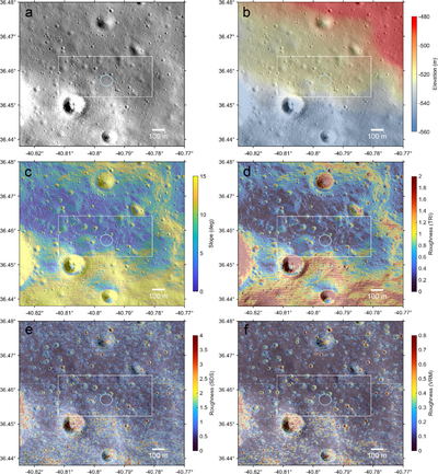
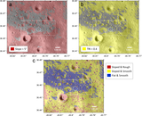
Caption: Figure 3.
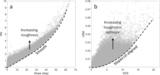
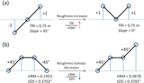
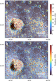
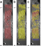
Region around the CP-21 landing area showing a portion of (a) NAC orthoimage M150783119 and colorized with (b) elevation, (c) slope, (d) TRI, (e) SDS, and (f) VRM with the 100 m diameter landing ellipse (light blue circle) and general area of operation (white rectangle) shown. The VRM values were linearly mapped to values 0–1, and contrast-limited adaptive histogram equalization (S. M. Pizer et al. 1987) was applied to stretch the colors.
Other Images in This Article
Copyright and Terms & Conditions
© 2026. The Author(s). Published by the American Astronomical Society.
Copyright ©
2026 Astronomy Image Explorer. All Rights Reserved.