Image Details
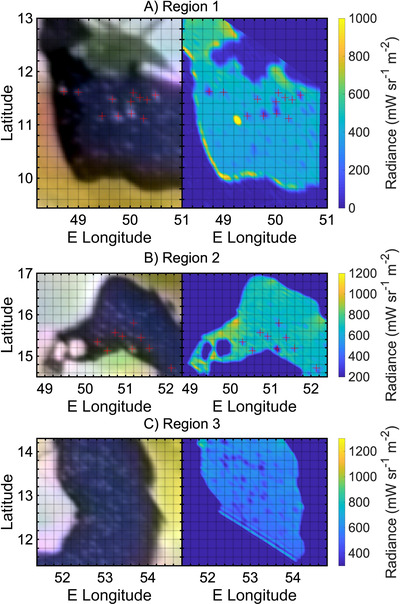
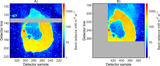
Caption: Figure 4.
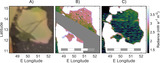
Visible and infrared maps of magnified regions 1 (A), 2 (B), and 3 (C). For each panel, the left part is the visible image and the right part is the M-band infrared radiance map. Color maps of the M-band radiance differ from panel to panel to enhance the islands. Red crosses indicate locations of possible islands, identified in both the VIS and IR images, and are in exactly the same places in both the VIS and IR maps.
Other Images in This Article
Copyright and Terms & Conditions
© 2025. The Author(s). Published by the American Astronomical Society.
Copyright ©
2026 Astronomy Image Explorer. All Rights Reserved.