Image Details
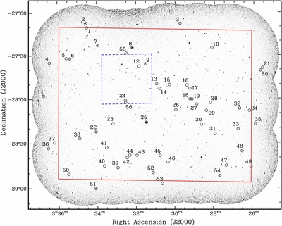
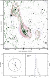
Caption: Figure 1.
Map of the ATLAS-CDFS field (third data release) showing the location of detected halos, relics, and complex and bent-tail radio sources. The red box shows the extent of the ATLAS-CDFS first data release. The blue dashed line frame represents the extent of the final VLA-ECDFS image. ID numbers correspond to Figure 2 and Table 1.
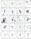
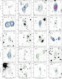
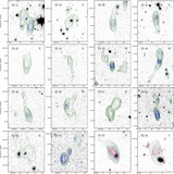
Other Images in This Article
Copyright and Terms & Conditions
© 2014. The American Astronomical Society. All rights reserved.
Copyright ©
2024 Astronomy Image Explorer. All Rights Reserved.