Image Details
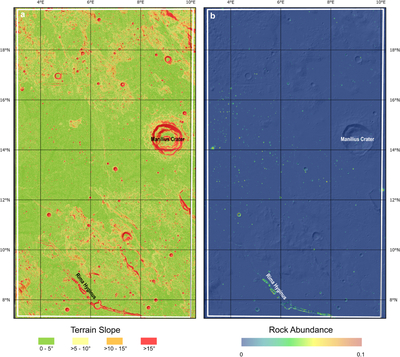
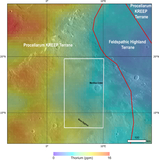
Caption: Figure 9.
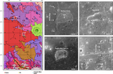
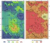
Landing site risk assessment can be supported by using (a) a slope map, derived from the Kaguya TC DEM (J. Haruyama et al. 2008), and (b) a rock abundance map from the Diviner instrument (T. M. Powell et al. 2023).
Other Images in This Article
Copyright and Terms & Conditions
© 2026. The Author(s). Published by the American Astronomical Society.
Copyright ©
2026 Astronomy Image Explorer. All Rights Reserved.