

Image Details
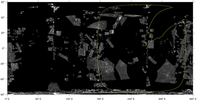
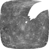
Caption: Figure 2.
Uncontrolled images included in the MDIS Global Basemap BDR (n = 1379; K. J. Becker et al. 2016) compared to the footprint of our Mariner 10 CLR-filter mosaic (trimmed to i = 85°, e = 77°; yellow outline). These images were removed from the basemap prior to selecting ground points for our Mariner 10 control network. Note that uncontrolled images were used to fill gores between controlled images and are generally only partially visible at the “top” of the MDIS mosaic.
Other Images in This Article
Show More
Copyright and Terms & Conditions
© 2026. The Author(s). Published by the American Astronomical Society.

Copyright ©
2026 Astronomy Image Explorer. All Rights Reserved.
