Image Details
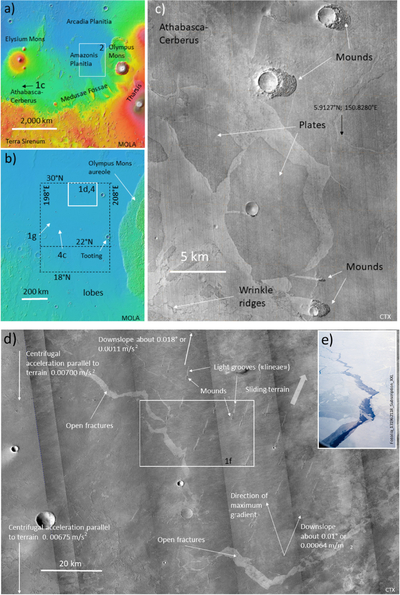
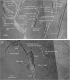
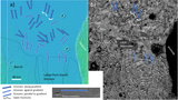
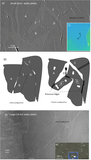
Caption: Figure 1.
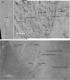
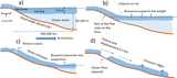
The surveyed area in Amazonis Planitia and an overview of the main topographic features examined in this work. (a) MOLA digital terrain model colorized hillshade map, with the Martian features adjacent to the area. (b) Enlarged MOLA digital terrain model map. (c) Plates in Athabasca–Cerberus. (d) CTX mosaic of the area marked in panel (b), with important features indicated. Shown also are values for the gravitational acceleration parallel to the ground and the centrifugal component of the acceleration. (e) Opening in the Arctic ice pack (Baiterek Media). Reproduced with license. (f) Detail of the area marked in panel (d). Selected MOLA tracks, elevations at some relevant points, and other interesting details are shown. Numbers inside and outside brackets are, respectively, MOLA and HRSC-MOLA blended 200 m DEM version 2. (g) Field of pressure ridges. Note a “ghost crater” that precedes the formation of the mound-groove, as the groove cuts through it. Location in Figure 1(b). In all images of this work, north is pointing up.
Other Images in This Article
Copyright and Terms & Conditions
© 2026. The Author(s). Published by the American Astronomical Society.
Copyright ©
2026 Astronomy Image Explorer. All Rights Reserved.