

Image Details
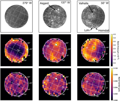
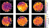
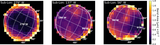
Caption: Figure 2.
The band areas and centers of Callisto’s 3.1 µm water ice Fresnel peak for three viewing geometries. The top row shows projected USGS albedo maps of Callisto stretched to allow for easier identification of the major geologic terrains. The middle row shows the band areas, and the bottom row shows the band centers. The approximate centers of the following geologic units are marked with symbols: Valhalla, ⋆; Asgard, ∘; Lofn/Heimdall, △. The subobserver longitude of each observation is indicated in the panels. The projected angular size of Callisto varies slightly between each observation, so the spaxel footprint is slightly different in each panel. Typical errors are ±0.07 × 10⁻⁴ µm for the band area and ±0.0007 µm for the band center.
Other Images in This Article
Copyright and Terms & Conditions
© 2026. The Author(s). Published by the American Astronomical Society.

