Image Details
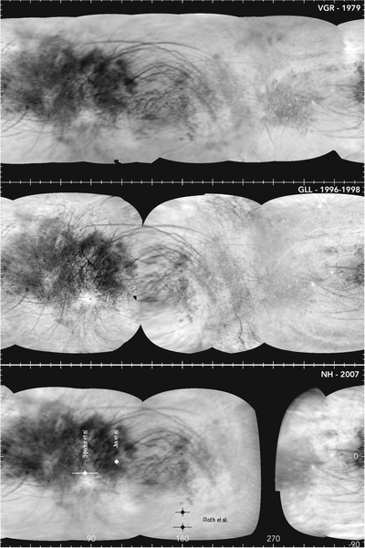
Caption: Figure 1.
Global image maps of Europa at ∼6 km pixel−1 scales. VGR, GLL, and NH. The NH map shows locations of proposed plume sites on Europa (Roth et al. 2014; Sparks et al. 2017; Jia et al. 2018). Global maps use these coordinates throughout.
Other Images in This Article
Copyright and Terms & Conditions
© 2020. The American Astronomical Society. All rights reserved.
Copyright ©
2026 Astronomy Image Explorer. All Rights Reserved.