Image Details
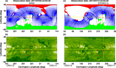
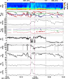
Caption: Figure 3.
Trajectory of WIND (the yellow curve near the equator) overlaid on (a) GONG magnetogram synoptic map and (b) STEREO extreme ultraviolet (EUV) Carrington map for CR 2111–2112 with central Carrington longitude of 321°. The intersection of the dashed vertical yellow lines and the yellow curve above the equator marks the position of WIND at 23:55:30 UT on 2011 July 5. The open field footprints in GONG map are colored red and green, representing positive and negative coronal holes, respectively. The closed field at the source surface is colored blue. The HCS at the source surface is shown in black. The two red rectangles mark two coronal sources. (c) and (d) are the same as (a) and (b), but for STEREO A during CR 2111–2112 with central Carrington longitude of 215°. The intersection of the dashed vertical yellow lines and the yellow curve near the equator marks the position of STEREO A at 23:55:30 UT on 2011 July 13.
Other Images in This Article
Copyright and Terms & Conditions
© 2018. The American Astronomical Society. All rights reserved.