Image Details
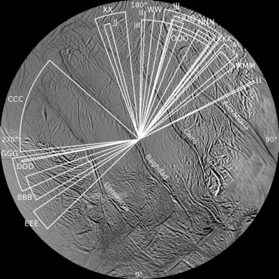
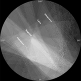
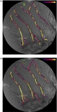
Caption: Figure 2.
Distribution of sub-spacecraft longitudes covered by the 18 imaging sequences used in this study. The observations were taken primarily during close satellite flybys when the spacecraft passed more or less on the side of the moon facing away from Saturn, a result of the inherent design of the Cassini trajectory. The sub-spacecraft latitudes on the moon were almost always near equatorial; this too was a result of trajectory design and the placement in time of the ISS imaging observations.
Other Images in This Article
Show More
Copyright and Terms & Conditions
© 2014. The American Astronomical Society. All rights reserved.
Copyright ©
2024 Astronomy Image Explorer. All Rights Reserved.